Magnetic Mapping from the Air — Fast, Safe, Reaches Tough Terrain
MagArrow mounts on a drone to map magnetic anomalies from above. Steep slopes, swamps, or wide areas impossible to walk can be surveyed in hours — with denser, cleaner data.
The problem: walked magnetic surveys are slow and can't reach tough terrain
Ground magnetic surveys require an operator to walk the site, metre by metre. On steep slopes, forest, swamp, or former mine areas this is slow, exhausting, even dangerous — and some terrain simply can't be crossed. Coverage is limited and schedules slip.
Walking across the land, or flying above it.
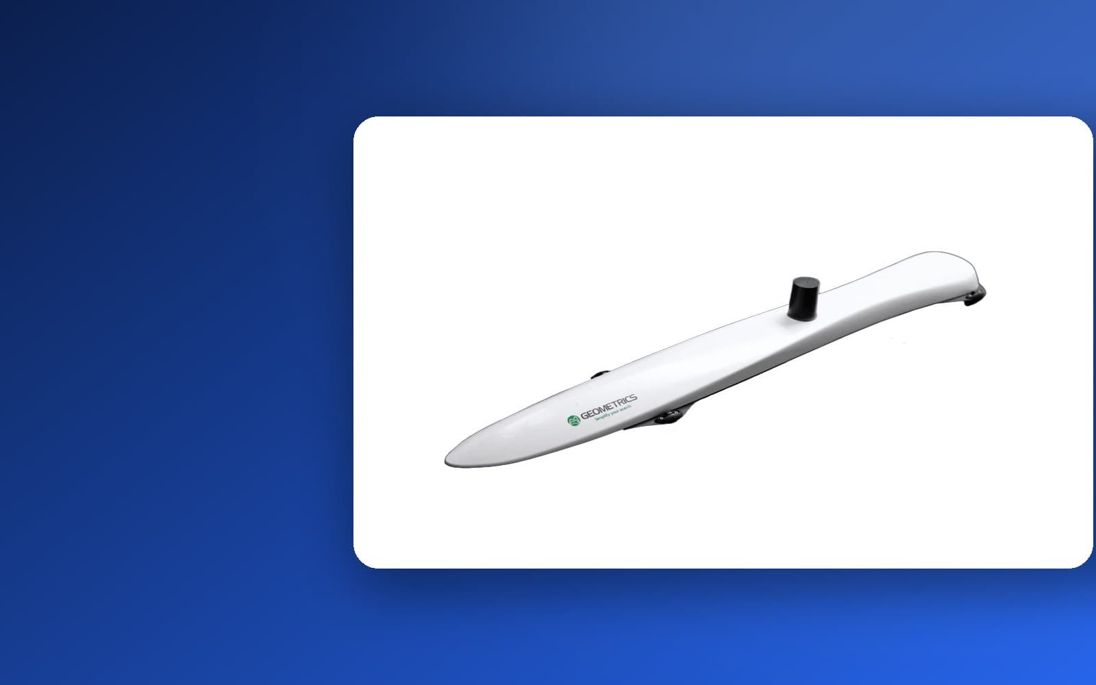
MagArrow is a self-contained, lightweight magnetometer (1.2 kg) that attaches to almost any drone. A 1,000 Hz sample rate produces dense data while flying fast. In Indonesia it is practically the only cesium-type drone magnetometer.
| Aspect | Walked Magnetic Survey | MagArrow (Drone) |
|---|---|---|
| Speed | Slow — metre by metre | Fast — wide areas in hours |
| Tough terrain | Hard/dangerous to reach | Slopes, swamps, forest covered from the air |
| Data density | Limited | Dense (1,000 Hz, a sample every ~1 cm) |
| Safety | Operator enters risky terrain | Operator stays in a safe spot |
How a drone magnetic survey works
Mount on the drone
MagArrow hangs from an enterprise drone with no extra data cables.
Fly a grid
The drone flies a grid pattern over the survey area.
Record at 1,000 Hz
The cesium sensor records the magnetic field densely, with onboard GPS.
Process into a map
Data is processed into a magnetic anomaly map for interpretation.
What you get
Magnetic anomaly map
A picture of magnetic structures and objects below the surface.
Fast wide coverage
Large areas done in hours, not days.
Tough-terrain access
Slopes, swamps, and forest mapped from the air.
Clean, dense data
High sampling with no dead zones for sharp results.
Who it's for
Drone magnetic surveys help those mapping large areas or difficult terrain:
Complete it: pair with ground magnetometers & a base station
To correct the Earth's daily field variation, pair MagArrow with a MagStation base station. For detailed point mapping, a land magnetometer such as MagEx complements the aerial survey.
Field proof
We're preparing an Indonesian drone magnetic survey case study — how quickly MagArrow maps areas that are hard to walk. Have a survey area? Contact us for a consultation or demo.
Why Jatific
Request a Consultation or Demo
Tell us your survey location and area size — our technical team will get in touch.
Frequently Asked Questions
- What is a drone magnetic survey?
- A survey that mounts a magnetometer on a drone to map the Earth's magnetic anomalies from the air — far faster, and able to reach terrain an operator can't easily cross.
- What makes MagArrow better than an ordinary magnetometer?
- MagArrow is self-contained at just 1.2 kg, uses a high-resolution cesium sensor sampling at 1,000 Hz, and attaches to almost any enterprise drone with no extra cables — giving dense, clean data quickly.
- Which drones can it use?
- MagArrow can be mounted on most enterprise drones. The Jatific team helps integrate it with your drone platform.
- What are magnetic surveys used for?
- Mineral exploration, geothermal and oil & gas, wide-area UXO reconnaissance, and archaeology — wherever subsurface structures or objects affect the magnetic field.
- Does Jatific provide training?
- Yes. Jatific provides consultation, demos, operator training, drone integration, and after-sales support across Indonesia.